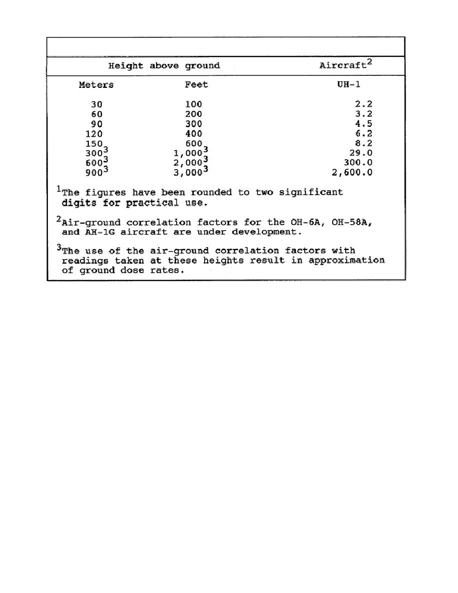
TABLE 4-2.
AIR-GROUND CORRELATION FACTORS
7.
Capability of Aircraft.
Light fixed-wing aircraft or helicopters are satisfactory for conducting
aerial surveys; however, because of the slow speeds required, helicopters
are the most desirable.
Light fixed-wing aircraft and helicopters have
approximately the same survey area coverage capability of between 130 and
450 square kilometers per hour per aircraft, depending upon the detail
required.
Order of preference of currently available aircraft for use in
aerial surveys is contained in Table 4-1.
8.
Recording and Reporting.
a. Recording.
The Radiological Data Sheet, designed for recording data obtained by
monitoring and survey, will be used for recording data obtained during
aerial surveys. Data obtained, using the route or course leg technique, is
recorded on the radiological Data Sheet, DA Form 1971-1-R; data obtained by
use of the point technique is recorded on DA Form 1971-R. Headings provided
in blocks are self explanatory.
In using the form, any heading not
applicable-to the situation may be lined through by the monitor. Space is
provided for use of the control party, as indicated, for entry of the air-
ground correlation
CM5206
4-14


 Previous Page
