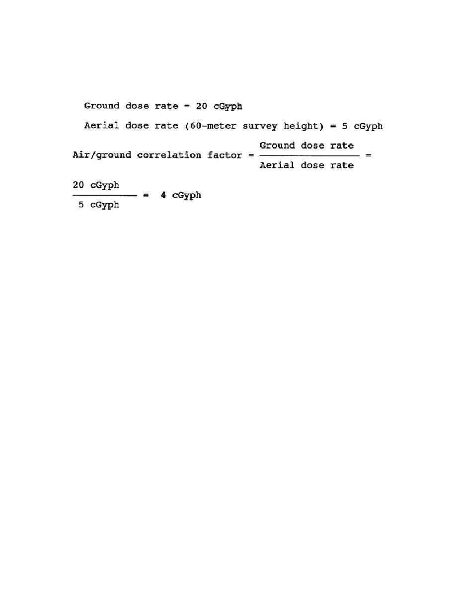
The preferred technique is by direct determination of ground and aerial dose
rates during the survey and subsequent calculation of the air-ground
correlation factor. The air ground correlation factor may be calculated as
shown below, using the aerial dose rate taken at survey height and ground
dose rate.
Then, by multiplying the reading taken in the aircraft at a survey height of
60 meters by the air-ground CF, the 1-meter above ground level reading can
be estimated.
The procedure for determining the ground dose-rate reading
involves landing near the selected point.
The monitor proceeds to that
point and takes the ground dose-rate reading, using normal monitoring
procedures.
Air-ground correlation factor data are obtained if possible for each two to
four course legs or routes flown.
The sites for obtaining air-ground
correlation factor data should be selected to approximate average foliage
and ground surface conditions in the contaminated area.
Accuracy of the
air-ground correlation factor data as to position, height above ground, and
dose rate is of primary importance. New data must be obtained when survey
height changes by 15 meters or more, when ground foliage or average ground
surface conditions change significantly, if the aircraft or the survey meter
is changed, or if weather conditions change drastically during monitoring.
When the tactical situation, terrain conditions, high radiation dose rates,
or other factors do not permit the use of the preferred technique, the air-
ground correlation factors shown in Table 4-2 are used.
To estimate a
ground dose rate, multiply the aerial dose rate obtained by the correlation
factor from Table 4-2 for the type of aircraft and the height above ground
at which the reading was taken.
For example, while flying at a 150-meter
survey height in a UH-1, a reading of 10 cGyph is obtained; the air-ground
correlation factor for a UH-1 at a height of 150 meters is 8.2.
Ground dose rate = Aerial dose rate x Air-ground CF
= 10 cGyph x 8.2 = 82 cGyph
4-13
CM5206


 Previous Page
