internationally through the World Meteorological Organization.
Decoding
procedure is given in TM 1-300. If current wind data is not given to the
required height, the latest available data from previous reports for the
higher levels are used to extend the plot. Up-to-date wind data that has
been obtained from a source as close as possible to the actual or expected
ground zero should be used.
Data from other sources, which report wind
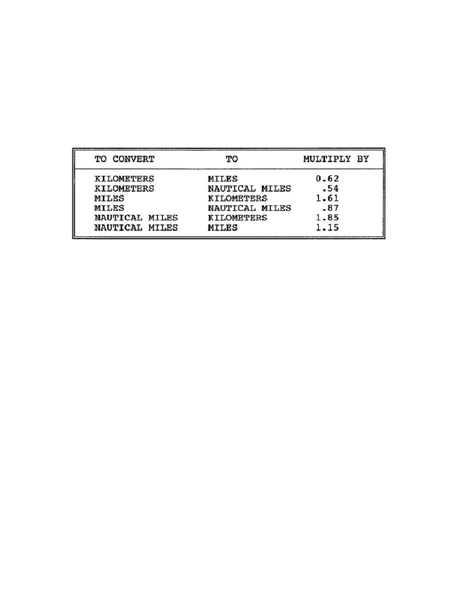
direction, speed, and height in units other than mils, knots, or kilometers,
may be converted by using Tables 2-2 and 2-3 on page 2-6.
Table 2-2.
Distance Conversion Table
3.
Air Weather Service (AWS) Constant Pressure Surface (Isobaric) Wind
Data.
The AWS detachments, attached to major command headquarters within the field
army, have the capability of providing estimates of the wind structure,
using constant pressure surface charts. When local upper air wind data is
not available, the wind structure, determined from constant pressure surface
charts, may be used to prepare a local fallout wind vector plot.
In
addition to supplementing local field artillery and AWS wind measurement
capabilities, the constant pressure surface charts can be used for two
special purposes:
a. Since they cover very large areas, they may be used to obtain upper
air wind data for fallout prediction at distant locations.
b. They may also be used to forecast wind speeds and directions used
for fallout predictions for periods from 24 to 48 hours.
2-5
CM5206


 Previous Page
