Step 2.
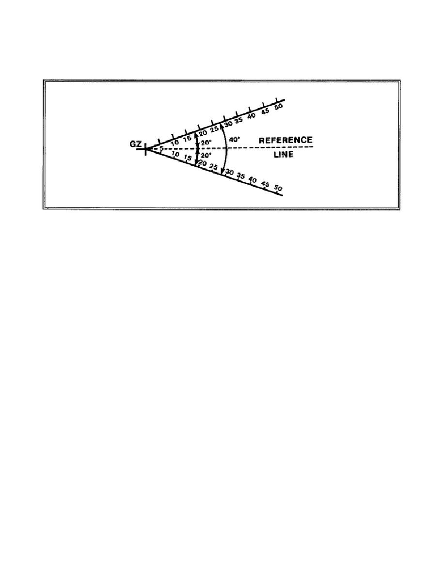
Draw and graduate in kilometers two radial lines from
ground zero at angles of 20 degrees to the left and to the
right of the dotted reference line (Figure 3-16).
Figure 3-16.
Radial Lines
Step 3.
On the side of ground zero opposite the reference line,
draw a series of concentric semicircles (using the selected
map scale) having radii of 1.2 kilometers, 1.9 kilometers,
4.2 kilometers, 6.8 kilometers, 11.2 kilometers, and 18.0
kilometers, which correspond to stabilized cloud radii from
nuclear bursts with yields of 2 KT, 5 KT, 30 KT, 100 KT,
300 KT, and 1 MT (1,000 KT) respectively (Figure 3-17).
Step 4.
Label the semicircles constructed in Step 3. Starting with
the semicircle closest to GZ and moving up from GZ, label
the semicircles A,B,C,D,E, and F; moving down from GZ,
label the semicircles 2, 5, 30, 100, 300 KT, and 1 MT
(1,000 KT).
To use the field-constructed fallout predictor, determine the downwind
distance of the Zone of Immediate Operational Concern from Figure 3-18 and
complete the simplified fallout prediction, using the procedures discussed
on pages 3-24 through 3-30.
The resulting prediction is then oriented by
placing a protractor over an actual or assumed GZ on the map and drawing a
line to represent the effective downwind direction for the yield group of
interest. Place ground zero of the predictor over ground zero on the map,
and rotate the predictor until its reference line coincides with the
effective downwind direction.
3-31
CM5206


 Previous Page
